Audubon Park Historic District

AP
Detail from Grinnell Map 1865
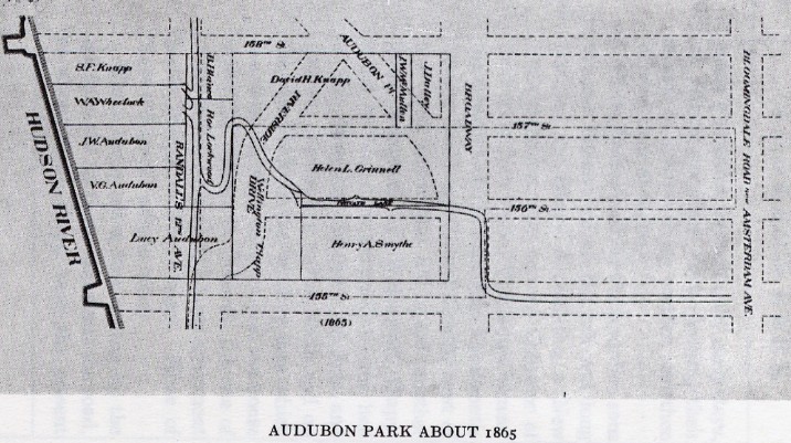
George Bird Grinell was in his late 70s when drew this map for his booklet, Audubon Park: The History of the Site of the Hispanic Society of America and Neighboring Institutions (published 1927) and had not lived in Audubon Park for more than fifteen years. Even so, his memories of more than six decades living there were vivid. The map is a composite of several different periods, so Lucy Audubon and (Mrs.) J.W. Audubon are included, even though Jesse Benedict and Julia Gould Jerome owned those two houses in 1865.
In 1865, Mrs. Victor G. (Georgianna) Audubon still lived in the house her husband had built in 1851, taking in borders to help with expenses. William A. Wheelock, who assisted Lucy Audubon with financial advice, had bought the second lot from the north on the Hudson River side a year earlier and lived there; in 1870, he purchased a large plot on the northern side of 158th Street, where he built a large mansion that remained well into the twentieth century. Bernice Abbott, working on a WPA Federal Art Project, photographed the Wheelock mansion shortly before it was demolished in the early 1930s.
Present-day numbered streets and Riverside Drive did not exist in 1865 and Randall's 12th Avenue was never constructed. The road winding through the property is left from the farm Minnie's Land. In 1865, Broadway stopped at 59th Street, though plans were already afoot to extend it through Trinity Cemetery to 155th Street. The extension of Broadway, known as the Boulevard until after the New York Consolidation, bore was called The Boulevard until 1899.
Webmaster's collection
Trinity Cemetery
Map Index:
Grinnell 1865