Audubon Park Historic District

AP
Detail from Bolton Map 1850 to 1860
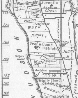
Webmaster's collection
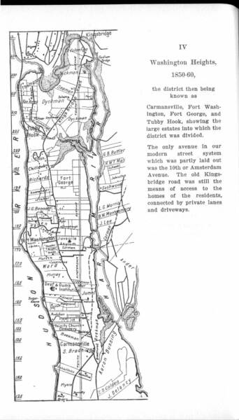
Reginald Pelham Bolton drew a series of six maps for his 1924 book, Washington Heights Manhattan: Its Eventful Past. Above right is a map depicting Washington Heights from 1850 to 1860, which accompanied a chapter entitled, "The Heights as a Residential District." On the left is an enlargement of the portion of the map containing Audubon Park (or Minniesland as it would have been known during the first part of that era). Although the disposition of buildings in Audubon Park does not agree with other accounts (including Grinnell's, who lived there for forty years), the map does give an idea of the distance the Audubons were from the main north-south artery in Washington Heights: the Kingsbridge Road.
Map Index:
Bolton 1850 to 1860