
Audubon Park Historic District
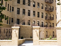
Recontructed entry:
779/789 Riverside Drive
AP
779/789 Riverside Drive (Crillon Court - the courtyard)
A diagonal line across the courtyard and through the front door of Crillon Court approximates one of the farm boundaries that Dutch colonists created when they divided Jochem Pieter's Hills, as the early residents of Harlem called Washington Heights, and assigned them by lots. That boundary, recaptured on John Randall's Farm Map in the 1800s and distinct on many successive maps, formed the original northern border of Minniesland, John James Audubon's home from 1841 until he died a decade later. At that time, some forty feet below the courtyard, two streams joined and flowed into a pond, before continuing on to the Hudson River.
The construction of Crillon Court in the mid 1920s dismayed both the residents of 158th Street, whose only view was of its rear, and those along the opposite side of Riverside Drive, (the Riviera and the Grinnell) because the building blocked their view of the Hudson. None-the-less, it has been a feature of the cityscape on this part of Riverside Drive for more than 80 years.
Two streams originated in springs on the high ground and flowed through Minniesland, joining and then “widening out in one place into a pond, at the lower end of which was a waterfall five or six feet high and very broad; the water fell into another pond, and below that the brook divided into two parts, forming a little island ” before it emptied into the Hudson.
Life of Audubon
Lucy Audubon
1869
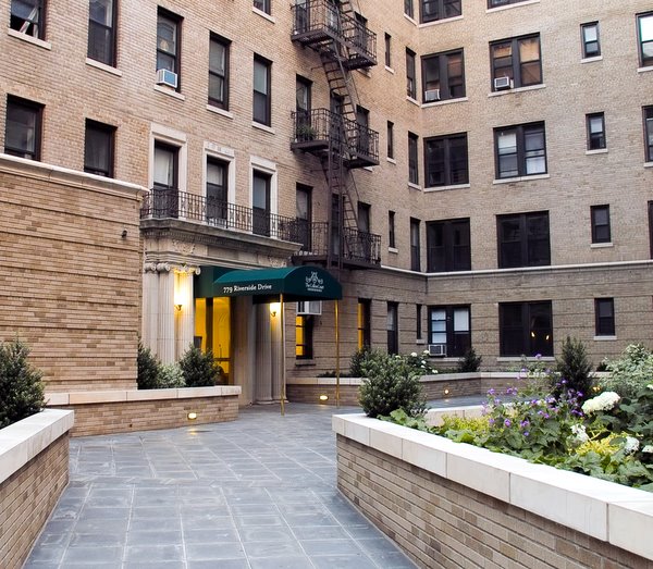
Photo by STR